Railway connection
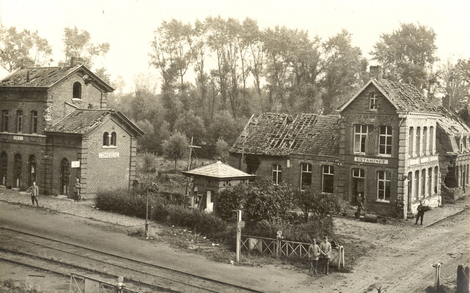
In an era of industrial progress, a rail link between Ypres and Roeselare was established in the mid-19th century. From 1864, hundreds of men worked for four years for meagre wages on this ‘line 64‘. To realise the railway line, considerable indentations and elevations are made in the sloping landscape. Several stops are planned along the route, including here in Zonnebeke and between Passendale and Moorslede. There will be a stately station building at both places.
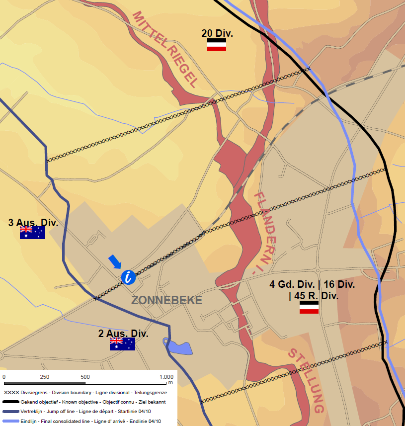
During WWI, the railway was particularly important for German troops. It carried material from Roeselare towards the Ypres positions. During the Third Battle of Ypres, the front line moved with difficulty along the railway towards Passchendaele. For the Australians it is their ‘Road to Passchendaele’. It is the only passable road in a totally destroyed mud landscape. It is vital during the Battle of Broodseinde on 4 October 1917. On that day, Australians take the entire area between the station and Tyne Cot.
Abolition of passenger traffic
After the war, the railway proved to be the best option to reach the devastated areas smoothly. Residents, workers and tonnes of materials are transported by it in droves. Eventually, passenger traffic is abolished in 1932 and no trains run from 1970. The tracks are broken up in 1977.
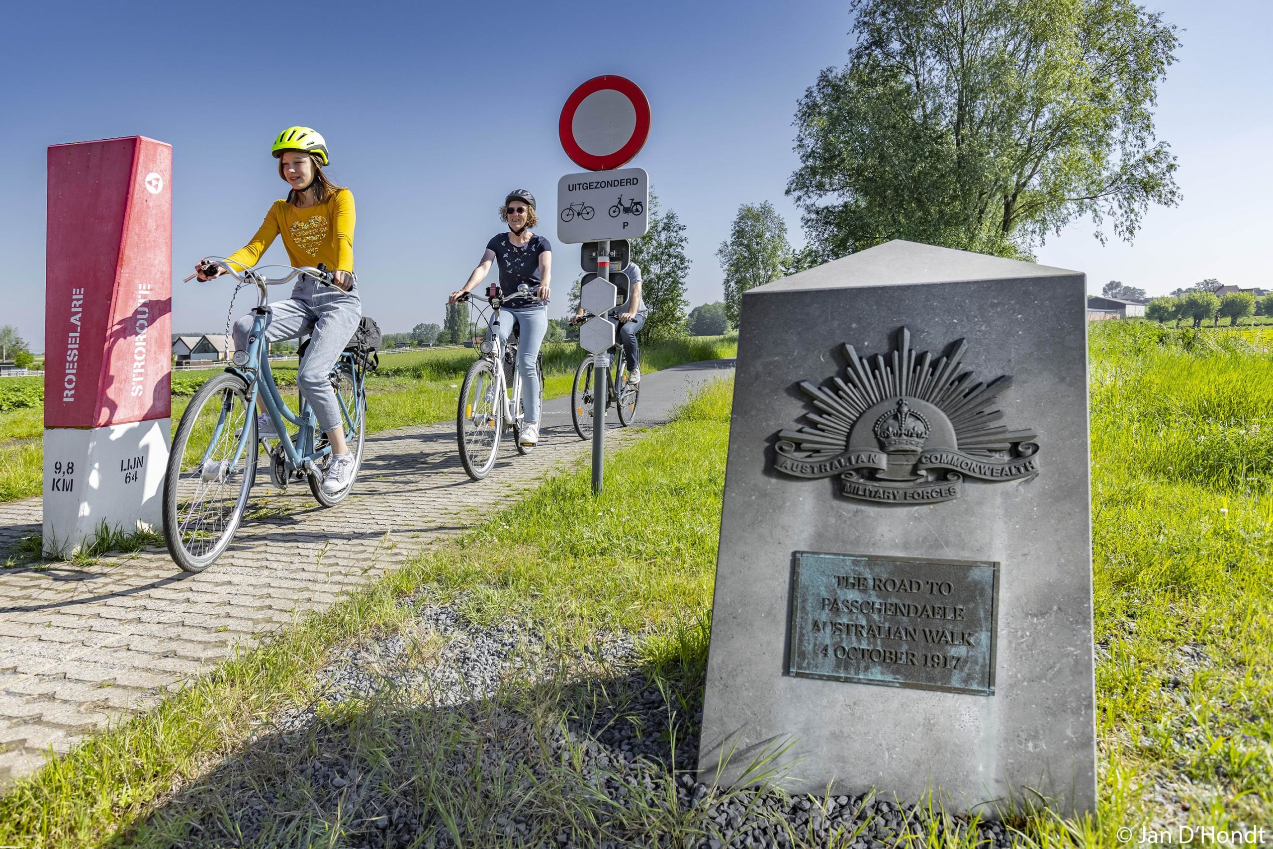
Even though there is no more rail traffic, striking relics of line 64 are still present in the landscape. The large-scale works in which the valleys and hillsides were conquered are still visible today. As is the rebuilt station, which stands opposite. Today, the ‘Stroroute‘, a recently renovated provincial cycle path that leads all the way to Roeselare, departs from here.
Practical
- Open: daily
- Can be guided
- Distance: 3 km
- Duration of visit: 90 minutes


