The reutel forest is a natural gem. Located in a valley, it is special because it was left untouched after the war. Remnants of bunkers and craters are still here. Today it is managed as a nature reserve.
German capture
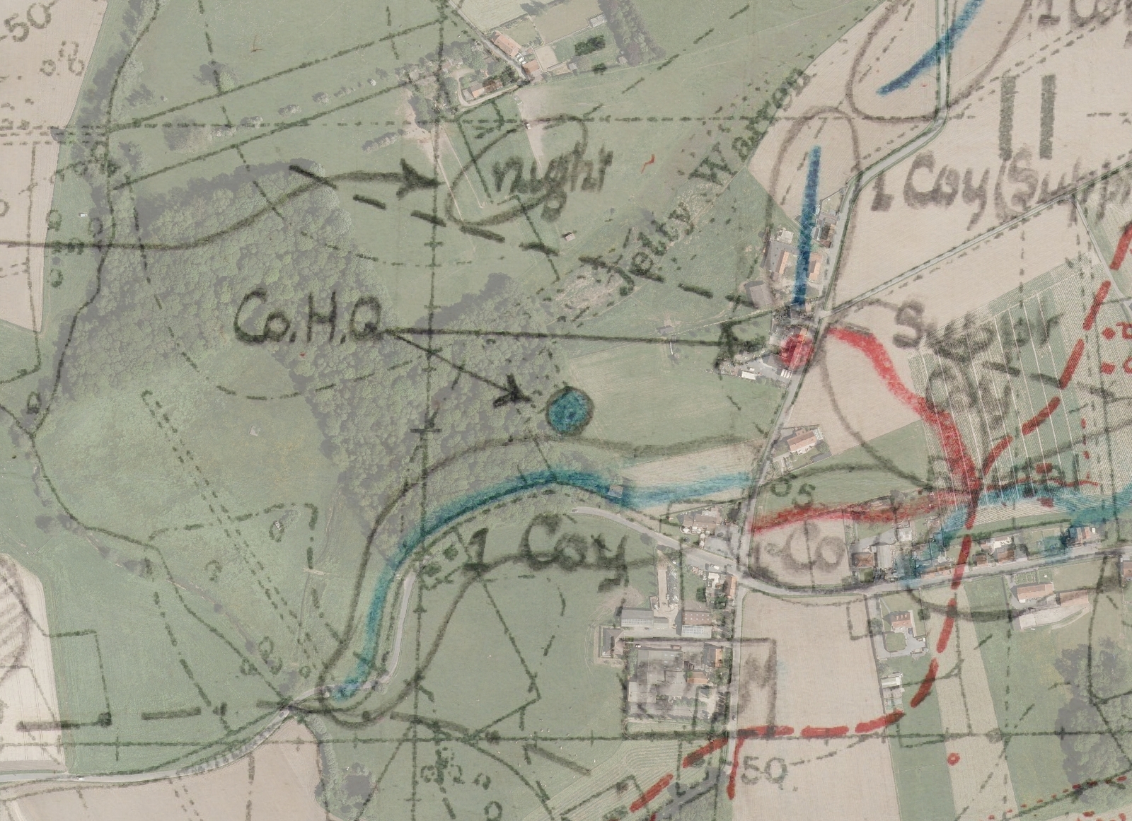
During the winter of 1914-’15, French and Germans sat opposite each other here at less than 40 metres. After the German capture, the Flandern I position was built on the current south-western edge of the forest. It was taken by the British 21st Division on 4 October 1917. A captured bunker is set up as company headquarters. After some skirmishes, the hamlet of ‘Reutel’ was taken. They did not get beyond that crossroads. The sector is defended by New Zealand troops during the winter.
Practical information:
- Part of the Polygon Wood walking route
- Can be guided


