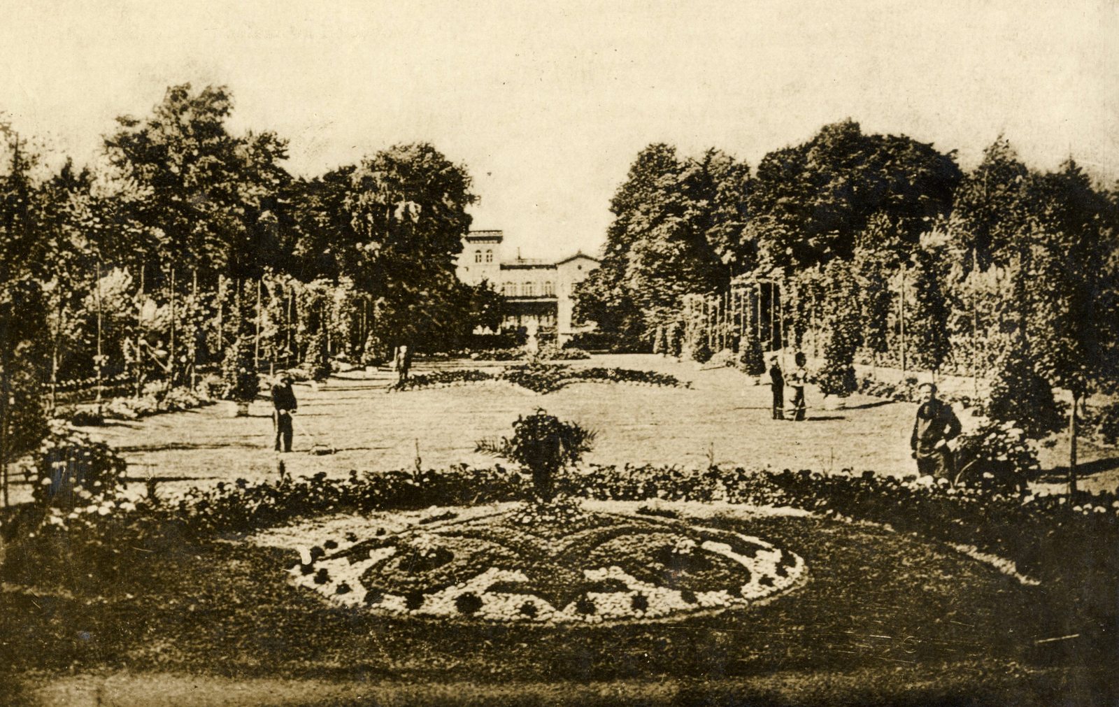
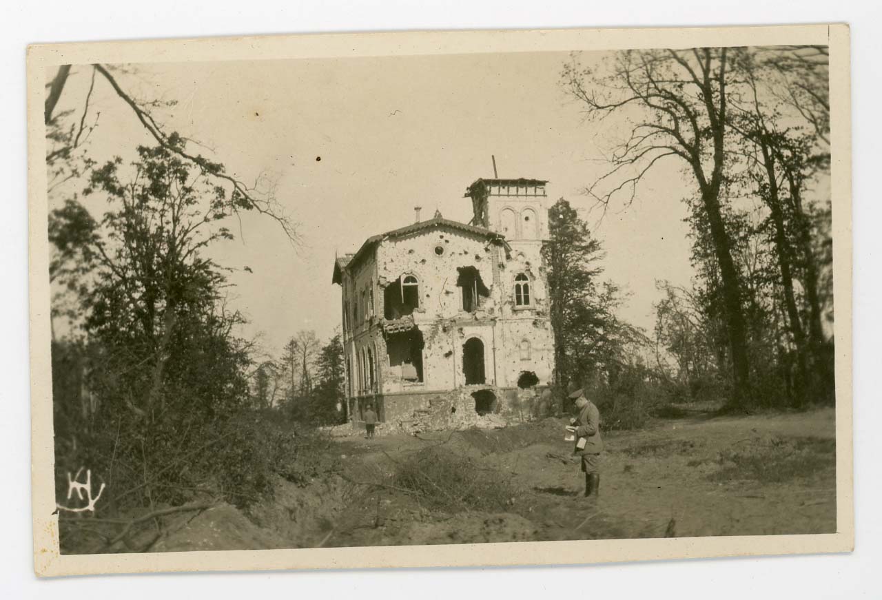
Flower castle
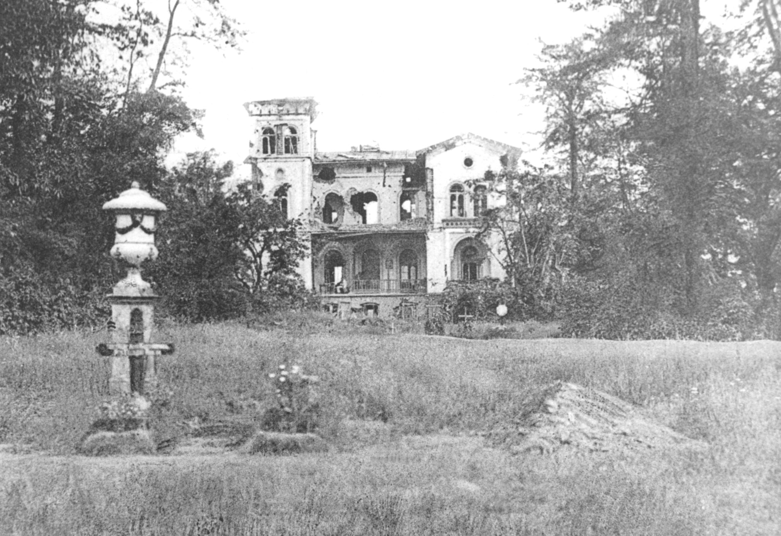
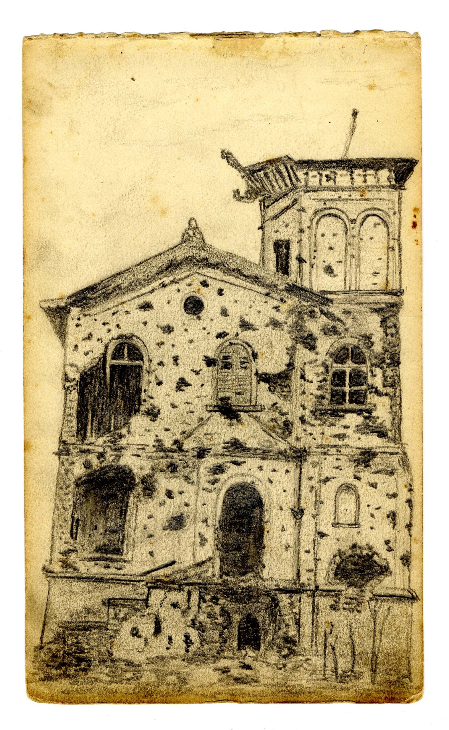
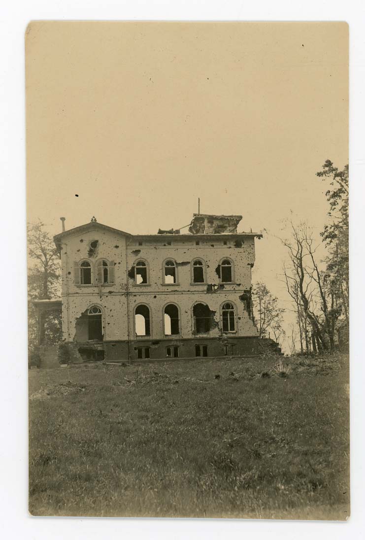
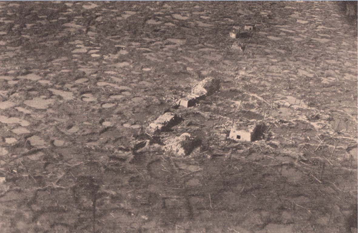
It is almost inconceivable but during the war, a beautiful park lay in the valley of Polderhoek. Situated around the south-facing Polderhoek castle, it was even one of the most beautiful in the area. The locals didn’t call it “Flower Castle” for nothing. It was laid out from 1850 and covered over 30 hectares. The front ran here in 1914. From then on, Polderhoek Park was in German territory. On 4 October 1917, British troops managed to take the north-eastern part of the park. They got no further and the offensive was halted on the ridge. The entire area was shot in ruins and the Reutelbeek, which flowed through the park, formed a wide swamp.
Heavy losses
On 3 December 1917, an attack on the park was still carried out. New Zealand troops had to finish the job. The whole operation failed. Men were shelled by their own artillery by sinking guns in the mud. Strong winds nullified the effect of a protective smoke screen. The deployment of untrained troops also contributed to the failure of the operation. Heavy losses near Passchendaele resulted in inexperienced reserve troops being sent into the battlefield here. Yet they fought fearlessly there.
Liberation offensive
The castle, or what remained of it , was only taken in 1918 during the liberation offensive. The castle lord Octaaf de Landas did not have the courage to rebuild the castle. He used his compensation to build a church and died in 1924.
Polderhoek Park
The landscape was totally destroyed by sustained shelling. So was Polderhoek Park, whose main entrance was along this street. Almost nothing remains of the park, once hailed as one of the most beautiful around Ypres. Between 3 and 5 December 1917, New Zealanders tried in vain to take Polderhoek here. The ruins of Geluveld remain in German hands.


